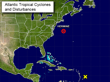
The latest on Post-Tropical Cyclone Hermine – Gradual weakening is forecast to begin by Tuesday morning
 At 800 AM AST (1200 UTC), the center of Post-Tropical Cyclone Hermine was located near latitude 37.9 North, longitude 68.3 West. The post-tropical cyclone is drifting toward the north near 3 mph (6 km/h). A gradual turn toward the north-northwest and northwest is expected to occur this afternoon and tonight. A northeastward motion is expected to begin by Tuesday night. On the forecast track, the center of Hermine will meander slowly offshore of the mid-Atlantic coast for the next couple of days. Maximum sustained winds are near 70 mph (110 km/h) with higher gusts. Hermine should remain near hurricane strength through tonight. Gradual weakening is forecast to begin by Tuesday morning. Tropical-storm-force winds extend outward up to 230 miles (370 km) from the center. The estimated minimum central pressure is 997 mb (29.44 inches). Read the rest here 09:28


Leave a Reply