


Updated Reports Available on Fishery and Port Impacts Associated with Offshore Wind Development Along the U.S. Atlantic Coast
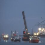
 NOAA Fisheries updated and expanded existing analyses and reports to help the public better understand the impacts of offshore wind development on commercial and recreational fisheries along the U.S. Atlantic Coast. The new reports build upon the previously developed analyses, but now include updated data and additional analysis on impacts to ports and cumulative impacts from all Greater Atlantic offshore wind lease areas combined.
What’s New?
We added 2022 fishery data to both commercial and party/charter impact summaries for each lease area and, for some approved projects, finalized export cable corridors, as reported by BOEM’s GIS website. We also added tables and figures depicting port-specific landings, revenues, and dependence upon fishing activities within lease areas and links to NOAA’s Community Snapshots, which provide detailed information on fishery dependence and economic and demographic characteristics. Finally, we added a new report that summarizes historic fishery landings, revenues, and individual vessel/port dependence for all Greater Atlantic Region offshore wind leases combined, which provides a conservative estimate of the cumulative impacts to fisheries and ports based on historic operations. All of these updates are also integrated into the data query tool, which enables users to organize the data to meet their individual needs. Together, these updates provide the latest information available to help estimate the potential impacts of offshore energy leases and approved projects on regional commercial and party/charter fisheries and associated fishing communities.
How Do I Access the Reports?
The socioeconomic impact reports and data query tool are both available online. All data included in reports and the query tool have been aggregated, as necessary, to protect data confidentiality.
Please note that this site will be updated once a year in June, unless otherwise noted. Due to the rapid pace of offshore wind development along the Atlantic coast, lease areas used to generate reports and associated data published on this website may be outdated. Data users are strongly urged to coordinate with NOAA Fisheries staff to discuss data limitations and acquire the most accurate and updated data through area/project-specific data requests when preparing socioeconomic impact analysis for individual projects.
Questions?
Fisheries Data: Benjamin Galuardi, Regional Office, 978-281-9187
Offshore Wind and Fisheries: Doug Christel, Regional Office, 978-281-9141
Media: Contact GARFO Public Affair


Leave a Reply