Daily Archives: September 10, 2017
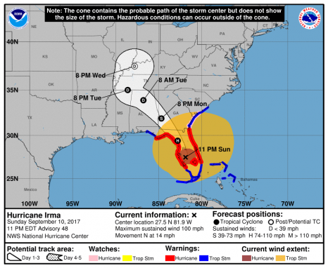
Hurricane Irma – Public Advisory – 1100 PM EDT Sun Sep 10 2017
At 1100 PM EDT (0300 UTC), the center of Hurricane Irma was located by NOAA Doppler radar near latitude 27.5 North, longitude 81.9 West. Irma is moving toward the north near 14 mph (22 km/h). A turn toward the north-northwest and then northwest at a faster forward speed is expected during the next day or so. On the forecast track, the center of Irma will continue to move over the western Florida peninsula through Monday morning and then into the southeastern United States late Monday and Tuesday. click here to read the update 23:34
Coast Guard urges mariners to contact watchstanders by phone during VHF outages
 ST. PETERSBURG, Fla. — The Coast Guard requests mariners in life-threatening situations along Florida’s Gulf Coast contact Coast Guard watchstanders by phone during the absence or degradation of VHF radio communications caused by Hurricane Irma. Mariners unable to reach the Coast Guard by VHF radio should use contact Sector St. Petersburg Command Center at 727-896-6187 or 727-896-6188 until radio signals improve or are restored. -USCG- 23:17
Hurricane Irma – Massive airborne relief mission en route to Keys to help with ‘humanitarian crisis’
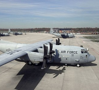 A huge airborne relief mission is en route to the Keys to help people impacted by the devastation caused when the eye of Hurricane Irma blasted through the Lower Florida Keys at daybreak Sunday morning. Monroe County Emergency Management Director Martin Senterfitt called the destruction caused by Irma, a massive Category 4 storm when it impacted the Keys, a “humanitarian crisis.” Among the services coming to the Keys are “disaster mortuary teams,” he said during a conference call. Supplies and personnel could be coming in by air to Monroe County by early Monday morning, Senterfitt said. click here to read the story 17:52
Hurricane Irma Makes Landfall on Marco Island
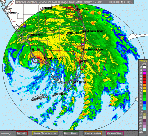 3:45 p.m. Hurricane Irma has made landfall on Marco Island, Florida, as a Category 3 hurricane. The National Hurricane Center in Miami said Irma’s powerful eye roared ashore at Marco Island just south of Naples with 115-mph (185-kph) winds, for a second U.S. landfall at 3:35 p.m. Sunday. Category 3 storms have winds from 111 to 129 mph, but 130-mph (21-kph) wind gust was recently reported by the Marco Island Police Department. Irma’s second U.S. landfall was tied for the 21st strongest landfall in the U.S. based on central pressure. Irma’s first U.S. landfall in the Florida Keys was tied for 7th. click here to read the story 16:23
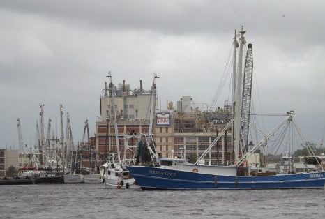
Hurricane Irma activates Jacksonville’s riverfront
Seeking shelter from Hurricane Irma, the First Coast shrimping and fishing fleet brings a little nostalgia back to the days when downtown Jacksonville was known as being an active working waterfront. In a strange twist of fate, the impending arrival of Hurricane Irma and the long abandoned piers of the defunct Jacksonville Shipyards have resulted in a bit of authentic Jacksonville returning to its historic downtown waterfront. Massive concrete piers built to complement the largest drydocks between Newport News and New Orleans, have become a key player in protecting the First Coast’s shrimping and fishing fleet from Hurricane Irma. click here to read the story 14:16
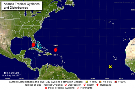
Hurricane Irma – Public Advisory – 1100 AM EDT Sun Sep 10 2017
At 1100 AM EDT (1500 UTC), the center of Hurricane Irma was located near latitude 25.0 North, longitude 81.5 West. Irma is moving toward the north near 9 mph (15 km/h, and a north northwestward motion with an increase in forward speed is expected later today, with that motion continuing through Monday. On the forecast track, the eye of Irma should move over the Lower Florida Keys shortly, and then move near or over the west coast of the Florida Peninsula later today through tonight. Irma should then move inland over northern Florida and southwestern Georgia Monday afternoon. click here to read the update. 11:10
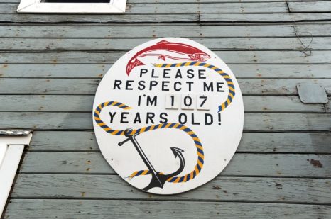
At Larsen Bay, a cannery where the tenacious rhythm of salmon season holds sway
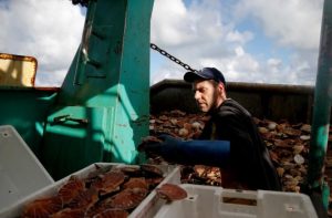
The steam whistle exudes a pink cloud as it announces break time. A forklift loaded with cookies and hash browns zips from the mess hall across the wooden planks on which the Larsen Bay salmon cannery is built. The forklift stops in a corridor within a corrugated metal warehouse. “Form Two-Lines,” a hand-stenciled sign instructs, pointing to either side of the table. The staff places the food on the table, alongside oversized coffee thermoses. It’s time for mug-up. Icicle Seafoods employees rush past other handmade signs on their way to the cookies. Slime line workers with rubber-soled shoes and hairnets pass signs warning “Do not enter, hot cans!” at the juncture where golden tins are transferred from the cavernous pressure cookers, called retorts, into the building where the cans cool. click here to read the story 10:26
New National Marine Fisheries Service Chief Addresses Anglers’ Concerns
 This past June, Secretary of Commerce Wilbur Ross named Chris Oliver as assistant administrator for NOAA Fisheries. His responsibility is overseeing the National Marine Fisheries Service. Oliver brings more direct fisheries-management experience to the role than some other recent appointees to head NMFS. The Texas native spent the past 27 years working with the North Pacific Fishery Management Council, first as a fisheries biologist, then deputy director and — for the past 16 years — as the council’s director. Despite his experience, Oliver’s direction on policy matters of importance to the nation’s recreational anglers and attendant industries have not been well known. It’s the purpose of this exclusive interview to change that and begin to establish an idea of what we might expect from the latest head of NMFS. click here to read the story 09:22


