


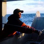
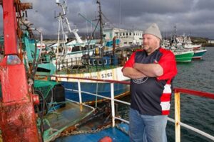
More things to worry about by Jerry Leeman
 Wind energy in the Gulf of Maine is going to be a great challenge to all varieties of commercial and recreational fisheries. What disturbs me the most is, in all my travels along the coast in the four major fishing ports in New England, very few commercial fishing Captains were aware of the new talks on changing the management stock areas and the reallocation of codfish. This is a concern for many now that they are aware. This raises the question, if no Capatin’s that fish inside the Wind Energy proposed areas were not aware of this future action, then how can the last comment periods on the proposed sights be accurately sighted?
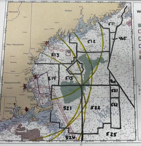
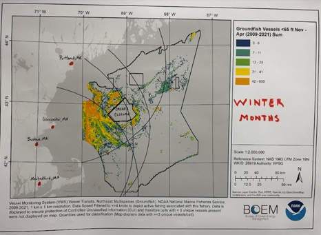
Changing broad stock area 521 off Cape Cod from Georges Bank quota allocation to Western Gulf of Maine allocation is a real issue. Imagine your permit’s catchable limits will be changed. Causing effort issues. Now add on the wind Energy Area east of Cape Cod will force pressure in the Wilkinson’s Basin and Murray Basin fishing grounds. This area is high in the abundance of choke species like Codfish, Gulf of Maine Haddock, and White Hake, which have been a big restraint to the fisheries efforts in these regions. Forcing effort into a concentrated area is never good for the effects of any resource. My rationale behind this argument comes from historical fishing footprints from data from VMS tracking years 2009-2021. NCCOS (National Centers for Coastal Ocean Science) showed the overlap of all vessel tracks in the Gulf of Maine and Georges Bank. While seeing all vessels overlapped on one chart it tells us nothing other than vessels have been in these areas. So, I had NCCOS take the same time frame and split the fleet from vessels under 65 feet and over 65 feet. Then asked them to split those fleets into seasons Winter months and Summer months through the same yearly time frame. These charts now show a story of effort patterns.
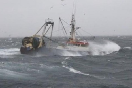
What was realized through these separated effort patterns is due to inclement weather conditions in the New England region, these charts show an effort pattern shift from vessels actively using the shoal and harder bottom effort in the Summer months to moving to deep water mud in the Winter months. When you have larger seas and inclement weather the chances of fouling up on the bottom pose a real danger to commercial trawlers due to hang-ups that could pose capsizing to vessels and crew safety.
Also, good to note looking specifically at the effort pattern of the vessels under 65 feet shows historically the fleet does not venture further than 100 nautical miles from any of the four major fishing ports in the New England region (Portland, ME. Gloucester, MA. Boston, MA. New Bedford, MA.). This being shown raises the question of access to historical fishing grounds. When looking at the current structure has broad stock areas 513, 514, and 515 which are currently the Gulf of Maine allocation areas for 3 species considered to be choke species due to allocation restraints. Changing this management structure including area 521 off of the Cape Cod region to become the Western Gulf of Maine area from the Georges Bank management area will force vessels further from shore outside their historical fishing grounds. Historically this analysis shows in the winter months, we have more concentrated effort in the Western region of the U.S. fishing grounds due to foul weather and quicker access to the fishing grounds amidst the ever-changing weather patterns. Accessibility is crucial for vital year-round fisheries. Without this access, it can be detrimental to holding fish markets specifically keeping a steady product supply. Once allocations are used up in this region it will force vessels out of the proposed Western Gulf of Maine regional area to transit offshore to further fishing grounds. Specifically, outside the 65 foot vessel’s historical fishing footprint to area 522. Area 522 lies outside the 100 nautical mile footprint of all the four major ports. This poses a severe safety risk to the vessels and crew’s safety and viable access to marketable fish stocks.
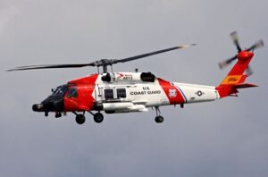
In easier terms, we will chew up fish allocations in the Western Gulf of Maine management area from concentrated efforts because of the Wind Energy proposed sites and force vessels to transit into furthermore dangerous waters. Transiting East to access George’s bank quota will have vessels transiting through Windmill sites that pose dangers from radar interference. Also should be noted that the US Coast Guard has no final analysis yet on how Search and Rescue will be able to effectively rescue vessels in danger inside these array areas due to radar interference as well.
These are the real concerns of the fleet and many in industry. We are forcing fishing efforts in a controlled area which forces vessels to transit East. Again the fishing Captains not knowing this issue brings the real question on the last Wind Energy Area comments as being incomplete. Knowing these shifts in area management and stock allocation change the entire dynamic of historical fishing footprints and accessibility to vital fish stocks. This will severely harm the survivability of the commercial trawling fleet. As well jeopardizing the future from keeping wild heart healthy product on the U.S. dinner table.


Leave a Reply